
Eastern Türkiye, near Van
About 39 km west-south-west of Van · 293 km from our Shaghik station
- Date17 November 2026
- Time19:57 local · 15:57:45 UTC
- MagnitudeM 4.4
- Epicentre38.485° N, 42.934° E · depth 14 km
Location and magnitude: AFAD (Türkiye), via EMSC · Records: CHARNET network, IGES
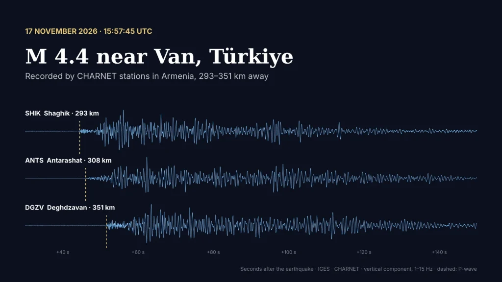
At 19:57 Armenian time on 17 November, an earthquake of magnitude 4.4 occurred in eastern Türkiye, about 39 kilometres west-south-west of the city of Van, at a depth of 14 km. Three CHARNET stations in Armenia recorded it clearly: Shaghik in the north-west, 293 km away, Antarashat in Syunik, 308 km away, and Deghdzavan in Tavush, 351 km away.
At these distances the first wave to arrive is a P-wave that has travelled through the uppermost mantle, below the Earth’s crust, where it moves faster. Deghdzavan lies 58 km farther from the epicentre than Shaghik, yet the wave reached it only 7.2 seconds later: about 8 kilometres per second.
from the earthquake to the first wave
Below are the records of the three stations. Press play to watch the waves arrive; the Z, N and E buttons switch between the vertical and the two horizontal components. After the first P-wave comes a long train of stronger waves that fades only after more than a minute.
1–15 Hz, 120 seconds of record (15:58:15–16:00:15 UTC), shown 3× faster. Blue — the P-wave. Sound: the Antarashat record, vertical component, played 15× faster. Location and magnitude: AFAD, via EMSC.
The Van region lies in the same zone of collision between the Arabian and Eurasian plates as Armenia and is one of the most seismically active parts of eastern Türkiye. On 23 October 2011 an earthquake of magnitude 7.1 struck near Van. Records like these help us study how seismic waves travel from the south-west into Armenia.
More earthquake sounds recorded by our stations: Listen to the Earth. The stations: Shaghik, Antarashat, Deghdzavan.