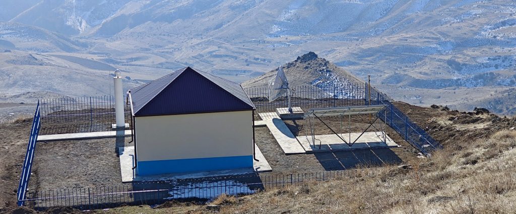
Elpin, above the Arpa valley
Arpa valley · between Areni and Yeghegnadzor · Vayots Dzor province
- Coordinates39.826° N, 45.105° E
- NetworkCHARNET · seismic and GNSS
- Altitudeabout 1,650 m
A station on rocks that remember the Tethys Ocean
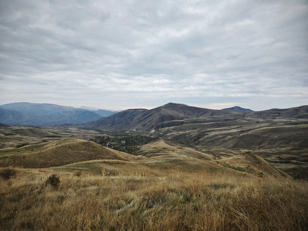
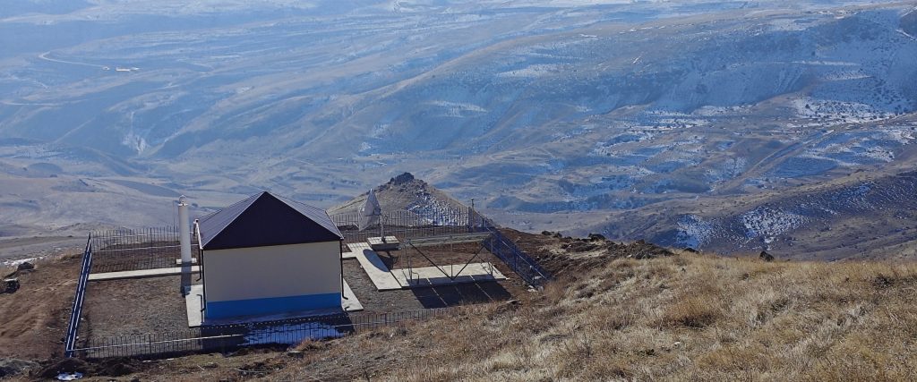
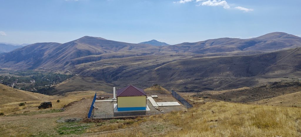
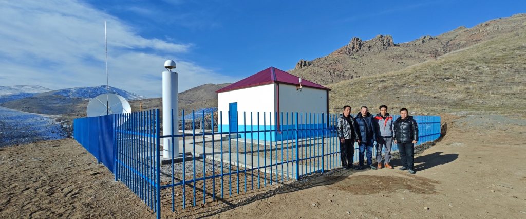
The third station in our series stands high above the village of Elpin in Vayots Dzor, on a bare ridge over the valley of the Arpa River, between Areni and Yeghegnadzor. In winter the slopes around it are dusted with snow, and from the fence the view opens onto folded hills, terraces and the snowy peaks to the north.
On a piece of ancient Gondwana
Vayots Dzor lies in the zone where the Arabian and Eurasian plates collide. Geologically, Elpin stands on the South Armenian block: a fragment of the northern margin of Gondwana that broke away when the Neotethys Ocean opened and was later joined to Eurasia. To the north run the ophiolite sutures of Vedi and Zangezur, the scars of closed Tethys ocean basins.
This is one of the few places in Armenia where Palaeozoic rocks come to the surface. The cliffs and gorges of the Arpa near Areni and Noravank are cut into these old shallow-sea limestones.
- Devonian – PermianShallow-sea limestones and sandstones, about 1.5 km thick. They form the cliffs of the Arpa gorge
- TriassicCarbonates that continue the Palaeozoic sequence
- CretaceousLimestones, in places with volcanic layers
- PalaeogeneFlysch, molasse and volcanic-sedimentary rocks
- Neogene – QuaternaryContinental molasse in mountain basins such as Yeghegnadzor; young lavas to the east
After Jrbashyan et al. (2001) and Danelian et al. (2025)
Young volcanoes next door
East of Elpin, near Vayk, there are two young volcanoes. Vayots Sar is a fissure eruption whose lava flow once blocked the Arpa valley and ran about 6 km to the west. Smbatasar is a cinder cone cut by a fault, with flows stretching 11 km to the north and 17 km to the south along the Yeghegis valley. Both are Holocene, geologically very recent. A tradition links the destruction of the towns of Moz and Yeghegis in 735 with an eruption and a strong earthquake; such an eruption is not proven, but researchers consider it quite possible.
Faults around Vayots Dzor
To the north-east runs the Pambak–Sevan–Syunik fault, the main right-lateral fault of Armenia. GPS shows it moving at about 2 mm per year, and it is capable of earthquakes of magnitude about 7. The Areni–Zangezur fault crosses the area itself. A station in this place helps us watch how these structures live.
Next door: Areni and Noravank
The same limestones hold some of the most famous places in Armenia. In the Areni-1 cave, archaeologists found what may be the world’s oldest known winery, about 6,100 years old, and a leather shoe about 5,500 years old. A little further, the monastery of Noravank stands among the red and grey cliffs of the Arpa gorge.
The station
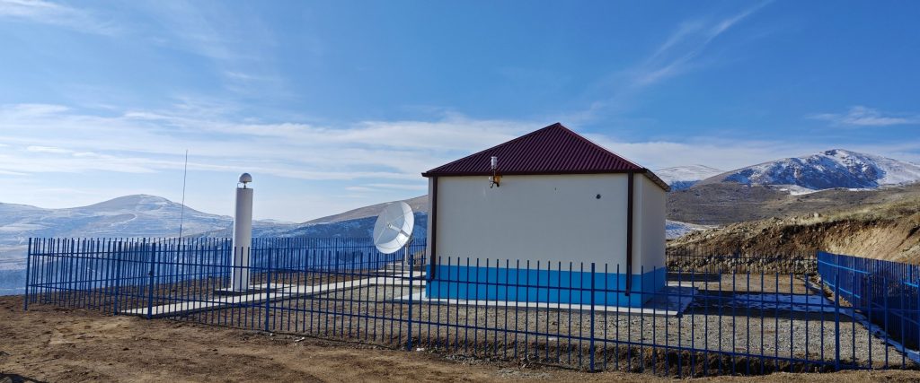
Elpin is a complex station of the CHARNET network: seismometers in the instrument building, a GNSS antenna on a white pillar, solar panels and a satellite dish. It stands on solid rock, and its site is one of the quietest in the network.
Sources: Jrbashyan et al. (2001), Geology of Meso-Cenozoic basins in Central Armenia; Karakhanyan et al., Holocene-historical volcanism and active faults in Armenia; Karakhanyan et al. (2013), Tectonophysics; Karapetyan et al. (2020), Russian Journal of Earth Sciences; Danelian et al. (2025), Reports of NAS RA. Photographs: IGES.