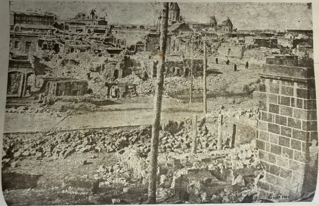
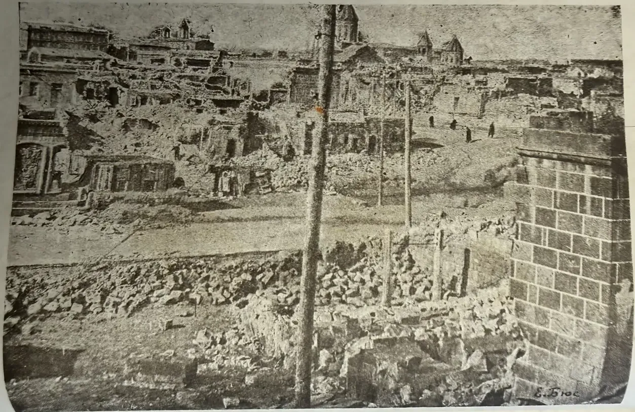
The Leninakan earthquake of 1926
E. Byus, V. Gigineishvili · Tbilisi, 1943
- Date22 October 1926
- Victims355
- Houses damaged¾
A copy of the book is kept at IGES
Sixty-two years before Spitak, Gyumri, then called Leninakan, was already struck by a strong earthquake. In the institute archive we keep a rare book about it: Leninakan Earthquakes of 22 October 1926 by E. I. Byus and V. M. Gigineishvili, printed in Tbilisi in 1943 as an offprint from the Caucasian Seismic Bulletin.
An evening of shocks
The first weak tremors came at 16:04 Greenwich time. Forty minutes later strong shocks followed, with an underground rumble. At 19:59 the earthquake returned even stronger, and the ground shook for about three minutes. People left their homes and spent the night in squares, on boulevards and in the fields.
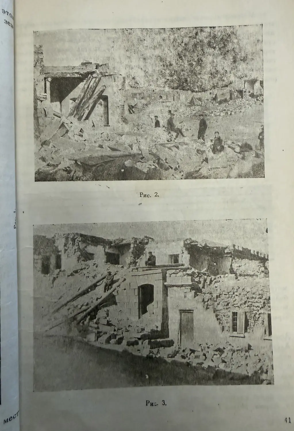
In Leninakan three quarters of all houses were destroyed or badly damaged. Villages to the south and south-west suffered even more: about thirty were hit, and ten of them were reduced to ruins. Telegraph and telephone lines to Tbilisi, Yerevan and Kars were cut. The earthquake took 355 lives, and about 400 people were injured.
The record in Tbilisi
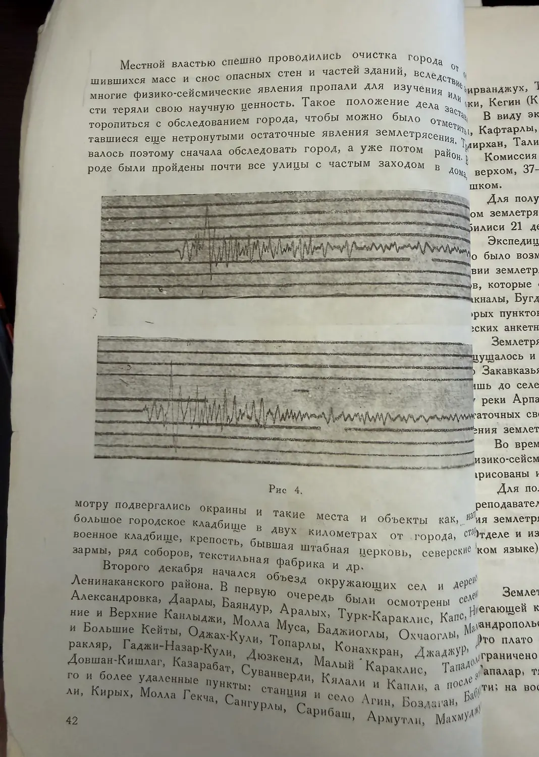
The seismographs of the Tbilisi station recorded the earthquake, but during the strongest part the pens swung so far that the trace ran off the paper. The book shows the record of an aftershock on 23 October made by a Golitsyn aperiodic seismograph.
A survey on foot and on horseback
The People’s Commissariat of Education of Georgia sent an expedition of two seismologists, a geologist and a photographer. It could leave only a month later, on 21 November, and in the end only two people went: Byus, head of the seismic department of the Geophysical Observatory of Georgia, and the physicist Gigineishvili. Byus also photographed some of the effects of the earthquake.
- 200 kmby car
- 125 kmon foot
- 85 kmby rail
- 70 kmon horseback
- 50 kmby cart
- 37 kmby railway handcar
Source: E. Byus, V. Gigineishvili, 1943, page 43
They walked through Leninakan street by street, visited the villages of the Arpachay plateau and returned to Tbilisi on 21 December. The next day, on 22 December, another strong earthquake struck the same area.
Monuments that turned
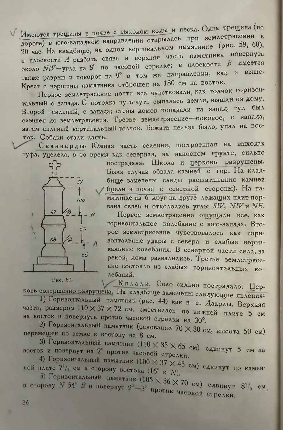
Some of the most curious traces were found in the cemeteries. Many gravestones did not simply fall: their upper parts turned around their own axis. In the two cemeteries of Leninakan the parts of a tall monument of black tuff rotated against each other by one to three degrees, and an obelisk broke from its base and turned anticlockwise.
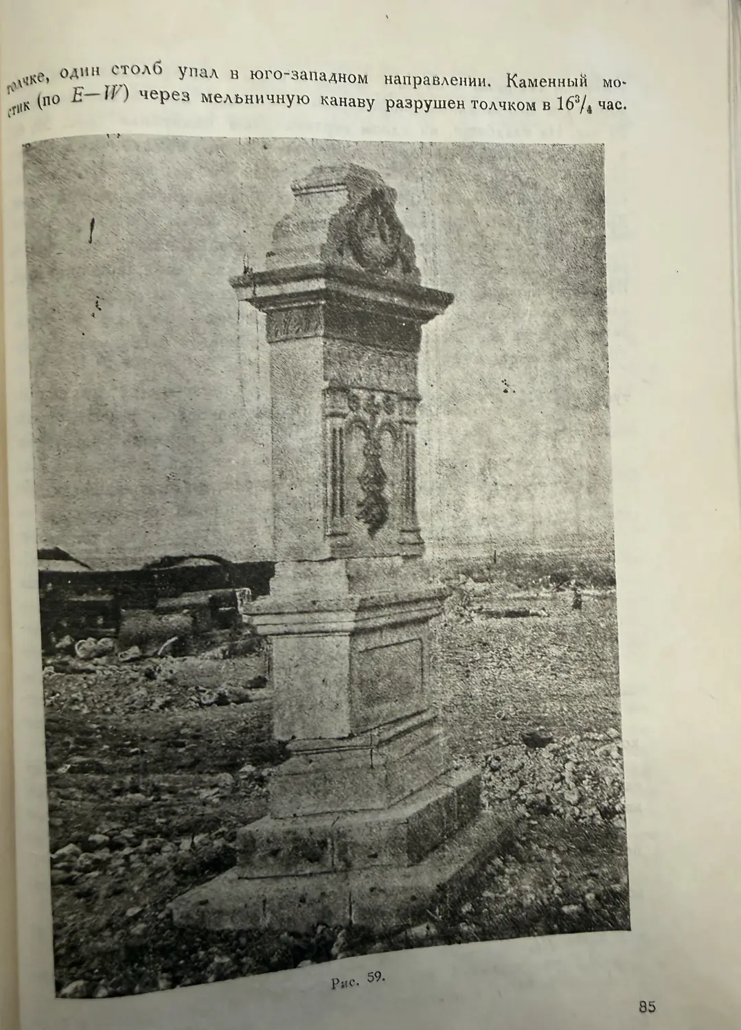
On one monument in a village cemetery the expedition measured the turn: 8° and 9° clockwise at two joints, while the cross from the top was thrown 180 cm to the east. Such rotations tell seismologists how the ground moved under the monument.
- ClocksOf seven clocks on walls running east to west, four stopped; of seven on walls along the meridian, three stopped
- CrackNear the Arpachay river the ground opened in a crack 20 cm wide
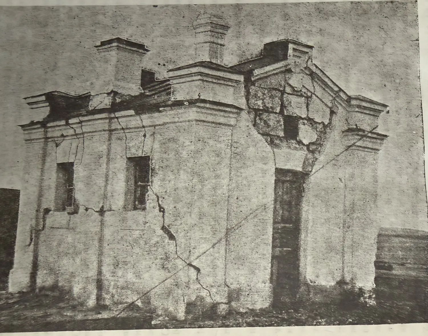
- StationAt Agin railway station the north and south walls leaned outwards and cracked
Source: E. Byus, V. Gigineishvili, 1943, pages 65–87
Earthquakes remembered
The book also collects older accounts of earthquakes felt in the region, from the 1827 shock in Gyumri to dozens of events between 1868 and 1899. These lists show that strong shaking near Gyumri was known long before 1926 and 1988.