
East of Aparan
Tsaghkunyats mountains, Armenia · about 14 km east of Aparan
- Date13 November 2026
- Time02:24 local · 22:24:33 UTC, 12 Nov
- MagnitudeML 1.1 · Mw 2.2
- Depthabout 10 km
Located by the CHARNET network, IGES · 4 stations
On the night of 13 November, at 02:24 local time, a very small earthquake of magnitude ML 1.1 (Mw 2.2) occurred in the Tsaghkunyats mountains, about 14 km east of Aparan. The epicentre lies at 40.56° N, 44.52° E, at a depth of about 10 km. An earthquake this small is not felt by people.
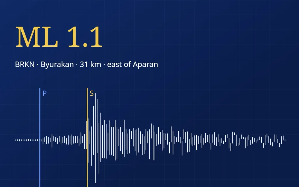
Four stations of the CHARNET network were used to locate it, from Byurakan, 31 km away, to Elpin, 95 km away. The farther the station, the longer the gap between the P- and S-waves: 4.5 seconds at Byurakan and 12.6 seconds at Elpin.
The epicentre (star) east of Aparan and the four CHARNET stations used to locate the earthquake. Hover over a station for its distance and S–P time.
between the P- and S-waves
Below are the north–south records of the four stations, from the nearest to the farthest. Press play to watch the waves arrive, or listen to the earthquake as Byurakan recorded it, sped up five times.
North–south component, 1–15 Hz, 40 seconds of record (22:24:33–22:25:13 UTC), shown 4× faster. Blue — the P-wave, gold — the S-wave. The farther the station, the later the waves arrive and the wider the gap between them. Sound: Byurakan station, north–south component, the whole record sped up 5 times. Location and magnitude: IGES, CHARNET network, 4 stations.
This is the third small earthquake located by CHARNET in northern Armenia in three days. On 10 November a tremor of ML 0.9 occurred under Aragats, 27 km to the south-west, and on 12 November one of ML 2.2 between Vanadzor and Spitak, 24 km to the north-north-west.
Even the smallest earthquakes matter: they show where the Earth’s crust is active. CHARNET stations watch Armenia day and night.